Saturday we left Sackville en route to Port Hawkesbury just over the Canso Causeway on Cape Breton Island.. But we planned to stop first in Truro, Nova Scotia where, we were told, we would be able to see the Tidal Bore. Some will know what the Tidal Bore is but some may not, so for the latter - the
Tidal Bore it is a wave of water running against the normal flow of water in channels, like rivers, which normally drain into the Bay of Fundy. The wave is created during the rising of the Bay’s huge tide which in some areas, at its peak, may reach as much as 12 to 14 meters.
The rising tide waters push the river water up stream reversing the normal river flow and, where the channel is relatively narrow, the Bay water rushing inland can create a wave reaching as high as one meter. We were pretty keen to witness this awesome phenomenon so when we reached Truro we set out to find the place to see it. The tourist information folks would be able to direct us, we thought, but they were closed. So, in the process of trying to find where to go we asked someone in a local business and, fortunately he was the right
 |
| Old bridge supports before tide began to rise. |
 |
| Old bridge supports 90 minutes after tide began to rise. |
Time to move on as we would like to get to Port Hawkesbury in time to get settled and have an enjoyable pre Mothers’ Day dinner, which we did.
We left Port Hawkesbury on our way to the Ceilidh Driving Trail (pronounced Kaylee) around 9 am in dense fog which, thankfully, cleared within the first few kilometres.
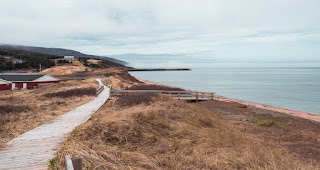
There is a parallel walking trail along the shore which we enjoyed for short bits along the way at Judique and Inverness Beach where we also had a bit of lunch.
We reached the Cabot Trail early afternoon and shortly after checked in at our cabin at Margaree Centre, not to be confused with Margaree or Margaree Fork, East Margaree, Northeast Margaree nor Margaree Harbour - eight Margarees in all!
 |
| Inverness Beach Trail |
 |
| Inverness Beach Trail |
Th place we stayed, “Browns - Bruaich na H’Aibhne” Suites (by the Banks of the River), was a unique collection of pleasant but aging cabins along with several trailers converted to rental “cabins” scattered about a lovely piece of property. After one night at Brown’s we headed out for Ingonish and decided to go by the Native learning centre “Wagmatcook, but it was closed.
Near the learning centre we happened on the Big Spruce Brewery in Nyanza and stopped by to sample their brew.
We tasted samples of the beer they had on tap and decided to buy a half growler (Yapper) of two of the four beers we sampled. One was a Pale Ale and the other a stout like beer which they call Cereal Killer!
This photo made in their tasting/drinking room with an awesome view includes and image of the samples of the four beers that they had on tap that day.
We then moved on to Baddeck where we picked up some groceries, had lunch and found yet another closed information centre.
A bit here about the advantages and disadvantages of doing this trip in the “off season”.
 |
| Near Margaree |
Too much rain has made getting out and about less than ideal and the temperatures have been on the cool side, not unexpectedly. And, as we knew from our two years in Nova Scotia years ago, no leaves on deciduous trees until June! And the second characteristic about Nova Scotia of which I am now reminded is the wind which seems to blow vigorously and constantly.
 |
| Lobster and Snow Crab traps |
From Baddeck we drove north on route to Ingonish and our overnight at the Knotty Pine. Now, like Margaree there is not just one Ingonish! We have Ingonish, Ingonish Ferry, Ingonish Harbour, Ingonish Beach and Ingonish Centre. Knotty Pines was in Ingonish Ferry on Ingonish Harbour. Several of the nearby bodies of water bear the Ingonish name - South Bay Ingonish, North Bay Ingonish, etc.
The Knotty Pine cabins are a bit closely, if not precariously, perched above the shore of Ingonish Harbour (photo right) so our room offered a lovely unobstructed view of the harbour.
Near the Knotty Pines at the entry to the Cape Breton Highlands National Park we found their visitors centre to be open!.. well, not exactly as they don't officially open until May 20th. But they were extremely welcoming and we were able to pick up some very helpful maps and information about the area and the National Park and we were early enough to be free of any fees!
On Tuesday, May 10 after a fairly cramped night in our tiny room we left the Knotty Pine and Ingonish for our next destination at Pleasant Bay.


No comments:
Post a Comment