Brace yourself because this is a long post. And, just a reminder to click on any photo to see a large version.
You may notice occasional font changes - Unfortunately, I have been unable to fix these so have to live with them.
You may notice occasional font changes - Unfortunately, I have been unable to fix these so have to live with them.
A couple of general comments and then a bit more on our first day trip before moving on to our day 2.
As I kept very sketchy notes while in Iceland, writing this with any degree of certainty has been a challenge. So, if my commentary seems a bit fuzzy it’s because it reflects my memory - that is, fuzzy.
 |
| A view across the bay from Brekka Lodge |
A bit about Iceland. The first permanent settlement in Iceland was established around AD 870 by outlaws and disgruntled anti-monarchy Vikings and Celts from Norway and the British Isles respectively. The main language of the settlers was Old Norse or the Dǫnsk tunga (Danish tongue). During the 12th and 13th centuries a number of great literary works - the sagas - were written by Icelanders. These sagas, many of which were the work of unknown authors, were written in a language very much like Old Norse.
From about AD 930 Iceland was governed by an early form of “democracy” through a nation wide “Þing“ - a kind of “parliament” of tribal chieftains who apparently met annually in an area within what is now the Þingellir National Park. Here, all important decisions affecting Iceland were made - laws were passed, marriage contracts were made and even religions agreed upon. Unfortunately, over the centuries increasing violence among the most powerful groups led to collapse of the Þing and subsequent take-over by Norway.
From 1262 until the 15th century, Iceland was governed by Norway, then by Denmark. During the periods of Norwegian and Danish rule, Norwegian and Danish languages were used in Iceland to some extent.
In 1944 Iceland gained its independence and the Icelandic language was revived as an official and literary language. Today there is a very successful publishing industry in Iceland and Icelanders are among the most enthusiastic readers and writers in the world.
 Now, back briefly for a bit more on our day one hike to the waterfall, Glymur, Iceland’s highest waterfall (198 meters), a hike we aborted about half way (or less) to the destination. In order to move forward from where we stopped, we would need to clamber through a cave, for what distance we knew not, in order to then
continue on a very rough terrain trail to the waterfall at least an hour further up the river gorge seen in this photo. From what we could see in the distance, in order to continue on the trail we would have to successfully walk over a single log bridge across a fast running stream… - well, you no doubt get the picture - this appeared to be an attractive challenge for 18 to 30 year olds that were entering the cave but out of the question for this octogenarian, and, I think, for our sexagenarian! Michael might have tackled it, but in the end we all agreed that we would turn back.
After aborting the hike, we decided to go on to Reykjavik to stock up on supplies for the coming days.

On our way to Reykjavik we noticed something we would see repeatedly, namely farms/buildings situated in the lee of mountains which presumably offer protection from the weather.

Day two - We had a relaxing morning before setting out for Þingvellir National Park, a drive which took us through amazing topography both on our way to the park and later to Geysir and Gullfoss water fall. Actually it's redundant to say "water fall" as "foss" means waterfall.
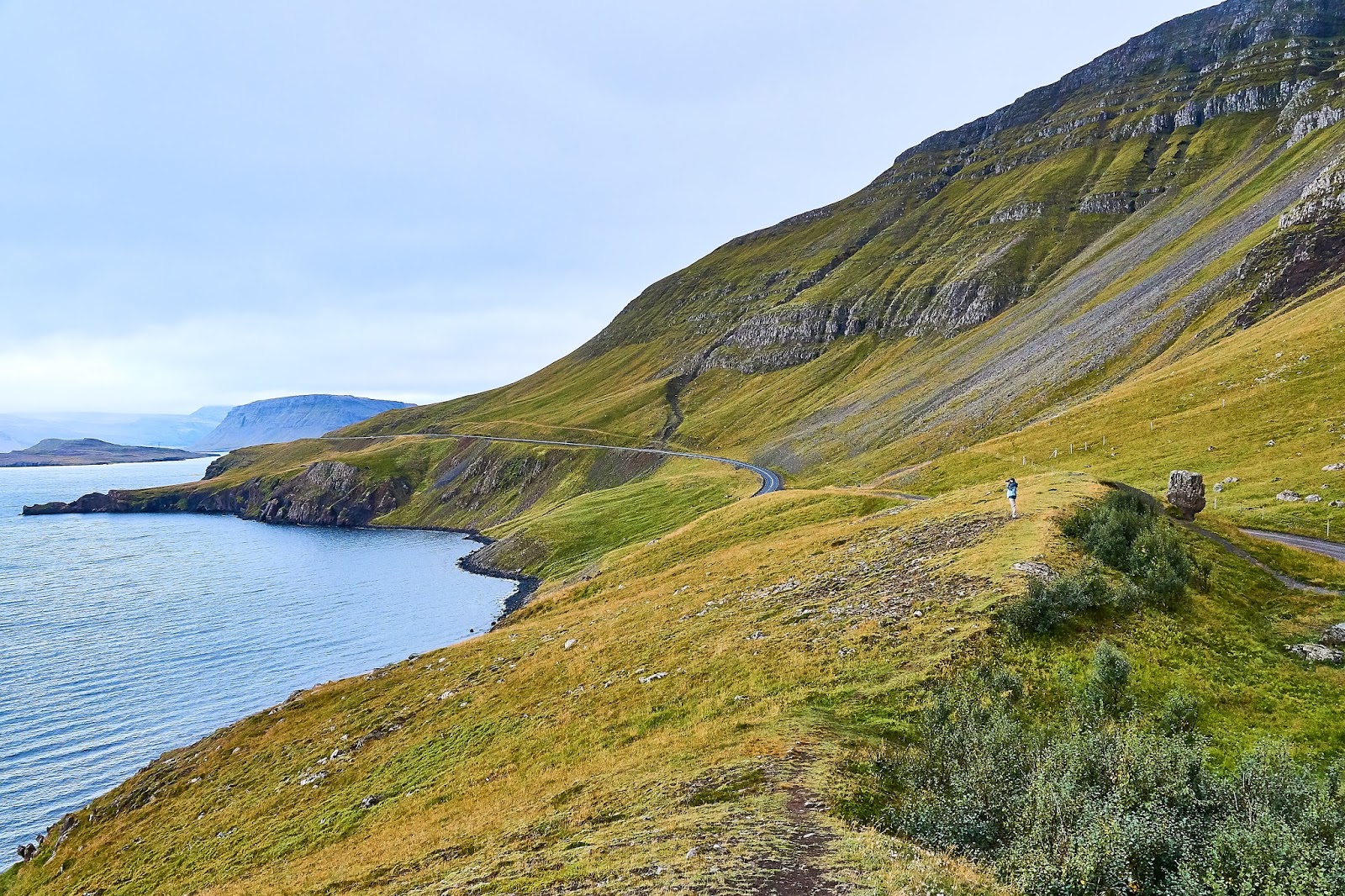
After rounding the tip of the bay we noticed a solitary "dock" on this spit of land. A road side sign described it as a “View from Hvitanes”, a view of what was a strategically important location in the protected end of a long bay inlet. This site is in the Hvalfjörður area - which during WWII saw naval bases for both Britain and the USA. At some point there were over 200 buildings including a hospital, movie theatre, living quarters and workshop for maintenance of the submarine barrier and the naval mines which protected the entrance to a harbour. Repair and supply ship convoys moved in and out protected from the German fleets in the north Atlantic by battleships from this harbour.

Between the Hvalfjörður area and the Þingvellir National Park we saw some amazing rugged beauty and stopped frequently to try to capture it!
For anyone who has had the opportunity to drive the Cabot Trail in Cape Breton some of these images may bring back memories. That is certainly what came to mind for me as we drove through these areas.
 |
| Note a tiny Michael in the distance |
I am unable to say where all of these images were made except that they are somewhere along our drive to Þingellir National Park.
Below, Rod is aiming at a relatively small waterfall (which you won't see). He is down behind the rocky area for two reasons. The most important one is that the wind was incredibly strong that day, so strong that you could literally lean into it almost without falling, and it was virtually impossible to hold the camera steady enough to get a reasonable photo. The second, of course was that his location offered a better view of the falls.

I don't recall for certain why we stopped in this location below though I think it was to take photos of several swans swimming in this small pond near the road.

I noticed and liked the colorful house (below) peeking up just across the road.

At the same spot just before leaving I stood in the middle of the road to get the photo below and just as I took the photo I heard a car approaching me from behind at a pretty good clip so had to move quickly to avoid disaster.


Inside the Þingvellir National Park near the huge fault shown in the photo on the right, the AlÞingi - the world’s first “democratic parliament” was established by the Vikings in AD 930. It was in the adjacent rift valley, created by the separating junction of the North American and Eurasian tectonic plates, that they met annually for about 4 centuries (see above information). It is said that the plates are currently moving away from each other at a rate of 1 cm or more per year.

The image left, though not a very good photo, shows the fault ridge wall and

the one to the right is the rift valley and somewhere out there is where the AlÞingi apparently met.

On to Geysir - site of the “hot springs” and, of course, geysers. It is said that this is the place that gave name to the general term "Geyser".
The area is literally “teeming” with geothermal activity bubbling and steaming at or just below the surface, along with at least 3 geysers which release their burst of steaming hot water at various interval - the one pictured here had intervals of about 10 to 15 minutes.

A bit beyond this one was an allegedly larger one that erupted every 30 to 60 minutes. We waited a bit but decided to move on to Gullfoss, the “Golden Falls” which is a relatively short drive from Geysir.


There are lots of stories about the name - Golden Falls - but the only one that sticks in my mind tells of a man who once owned the property on which the falls is located. He was apparently very wealthy with lots of gold. It is said that he was so fearful that someone would rob him of his gold that he decided to hide it in the falls. Getting it in was easy, getting it out would have presented more of a challenge!

After Gulfoss, home for a great Rod Marr meal, hopefully a hot tub and photo processing. Unfortunately, the barbecue lacked fuel and smelled overpoweringly of fish forcing a more difficult meal preparation for Rod. The meal was excellent in spite of the difficulties!


