Saturday, October 7, 2017

Friday Sept 15 - Day 7

As planned, today we returned to the area around the east side of lake Mývatn, stopping once again, briefly, at Goðafoss this time on the side opposite our earlier visit. We concluded that this point of view offered little over what we had already seen so moved on to our destination on the east side of the lake.
Remember to click on any photo to see a larger version.

Just a brief aside here concerning the name, Mývatn, which means ‘Lake of Midges’. Apparently in the summer swarms of these small flies are an unwelcome plague for visitors. Though they can be very annoying (we did have minimal contact with them and they could, in large swarms be very annoying) visitors are asked to keep in mind that they are a vital food source for local wildlife. Recommendation:  if they bother you, put on a head net, apply bug repellant generously and hope for a vigorous wind!
Moving on. There are three areas that we intended to see today, the cave, Grjótagja, the volcano Hverfjall and Dimmuborgir’s lava pillars and spikes mentioned in my day 5 post.


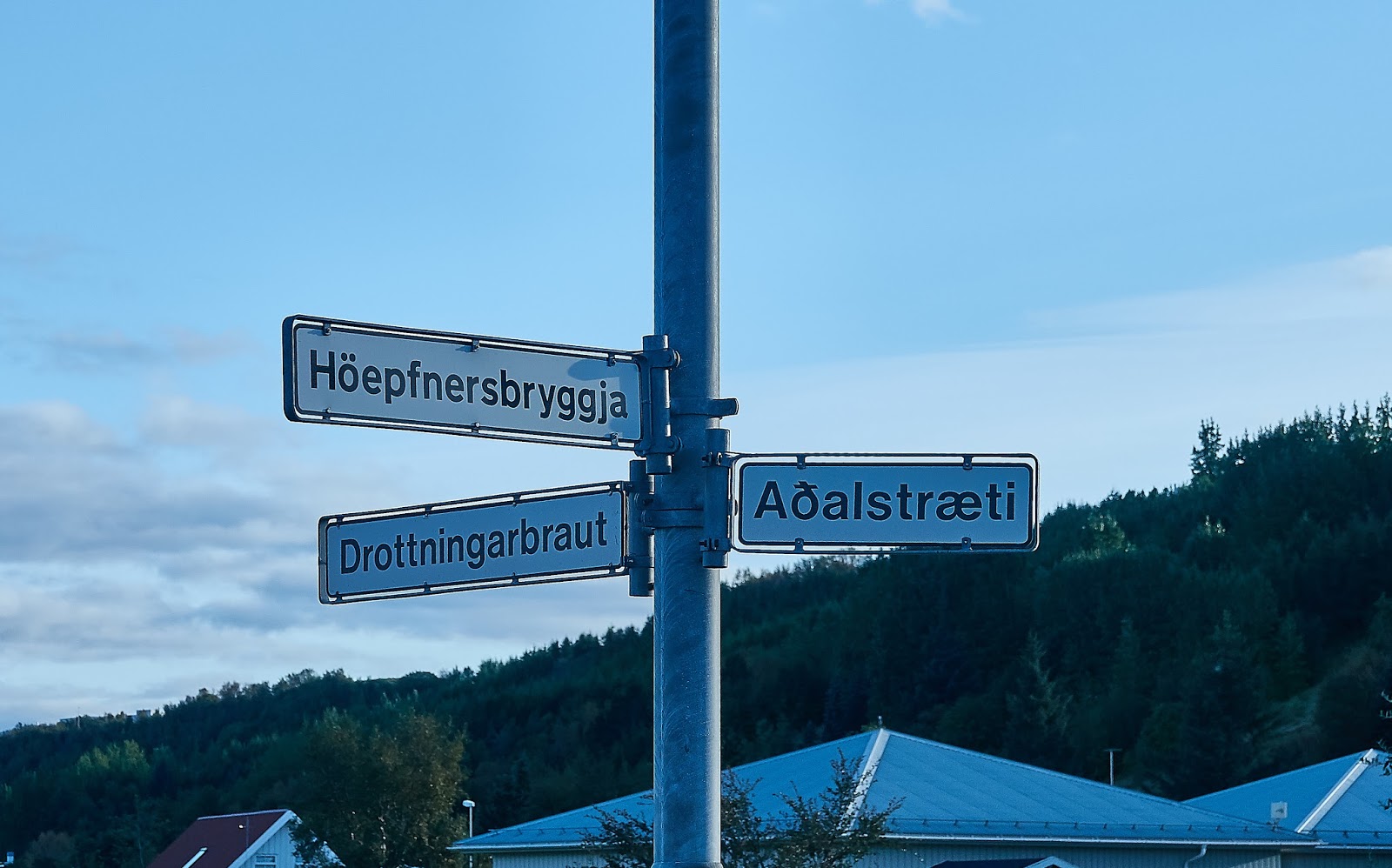
Now, writing this almost 3 weeks after returning home makes it difficult to remember times and places precisely.  I recall that during the day before we reached our destination we found an interesting short hike which provided some excellent scenic points of view of the area, though it was not on our list of places we had planned to visit today. This is the Höfði peninsula which juts into Mývatn lake on the east side. There is a lovely trail which starts by the parking lot and leads, through a small forest along the lake shore, to these beautiful lava formations and lots of bird-life. The first three images were made on this brief walk.
When we reached our planned destination we opted to take the hike to the cave first and found that the 40 - 45 minute walk took us through the most surprisingly beautiful terrain. 

Mixed in with the black lava base were craggy black rocks of various heights amidst amazingly bright coloured flora which included mounds of moss and lichen and what appeared to be stunted birch bushes in addition to other low lying colourful leafy plants. 
At some places there was a fairly sharply defined edge of the flora and adjacent large areas which appeared to be completely devoid of the plants covering the terrain we were walking through.
This experience was a complete surprise and for me it was certainly one of the highlights of the day and possibly of the trip.
Michael just inside the cave.
When we reached the cave I found it interesting but a bit anti-climactic after the spectacular landscape we had just come through.
The cave might be familiar to those who follow The Game of Thrones, as some parts of that show were filmed here. Much of the upper portion is formed by huge rocks wedged at a variety of angles against each other leaving large open areas between the rocks. These allow quite a bit of light into the inner area which is partially filled with 45 degree water.  When the sun is shining, which it wasn’t, the effect of the sun entering through the open areas apparently provides interesting light inside the cave. According to the signs it was once a popular swimming area but swimming is no longer allowed.
I like the blurred image of Michael. Adds a bit of a (smiley) ghostly effect.
Volcano Hverfjall
We retraced our steps to return to the car then moved on to the volcano Hverfjall which you can see in the distance here.
This huge classic ring crater, dominates the lava fields on eastern side of Mývatn. The residual nearly symmetrical rim rises about 450 meters and is over 1 kilometer across!
The crater apparently appeared about 2700 years ago in a violent eruption.
What remains is composed of loose gravel seemingly barren of plant life though a closer look reveals scattered bits of vegetation which made me smile. It is indicative of the resilience of plant life capable of finding root in the seemingly hostile environment of this pile of gravel.
Travel books say that there is an easy trail up to the rim and, while the trail is not rugged, it is steep and long with the degree of incline increasing the closer you get to the top. In this photo you can, if you look closely at Hverfjall in the distance, get a glimpse of the trail up the side.
I have to say that I had to rest several times on the way to the top but, with encouragement, I did reach it!  I don’t think I was the only one taking a bit of a break now and then either. And we didn't notice other identifiable octogenarians among the climbers we saw.
To get the sense of height, note the vehicle on the road below
The view from the rim was quite stunning both inside the crater and in the panoramic perspective of the surrounding area outside including areas like Krafla that we had visited a day or so earlier.
The path down was much easier, from a cardiopulmonary stand point, than going up but presented its own challenges for knees and back along with the risk of falling as a result of losing one's balance on unstable rocks. I'm happy to say that I made the climb to the top and the walk down without incident.

Remember the geothermal power plant? See it over there?
It was here that I had my first encounter with an Iceland public restroom facility. The first surprise is that, in order to get in, you must pay 200 Krona. I happened to have the correct coin (not sure what one does if one is without cash) so inserted it and received a paper “receipt” which must be scanned to allow entry. What I didn’t expect was that I also needed that piece of paper to get out and I had tossed it into the trash. Fortunately, I am still flexible enough to climb over the obstructing rotating bar  - or in this case non rotating bar - in order to exit.

From here we drove to nearby Dimmuborgir (literally, Dark Castles) which, along with Grjótagja and the volcano, Hverfjall, where we had just visited, is part of the eastern Mývatn lakeside hike. We originally planned to hike to each of the places but it was a lot of ground to cover during the time available so driving seemed the better travel choice.
Dimmuborgir is a huge area of unusual large lava pillars and crags. It is believed to have been formed around 2000 years ago when a lake of lava from nearby volcanoes formed over a marsh or lake. It is said that hot lava heated the water to boiling pushing water through the molten lava and cooling it to form, over time, the pillars and varied forms of lava rock seen in this area today.
I have a lot of photos of this fascinating area but I think these two give a pretty good idea of what we saw there.

So, it is the end of our last day before the drive back to Keflavik airport and the 5 hour flight to Toronto.

And, as it was our last day, we decided to have dinner at the restaurant said by some locals to be the best restaurant in Akureyri.  And, it may well be the best as we found both the food and the ambiance to be excellent and the best we experienced in Akureyri!

Because of the long drive and the need to catch a flight, we passed many potentially excellent photo opportunities, giving in only once, on route to Keflavik.

Our drive to Keflavik took us through Borgarnes - remember Borgarnes? It’s the place where I left my Algarve baseball cap in the restaurant. In spite of the time pressure to get to the airport, Michael wheeled into the parking lot at the restaurant, I went in, retrieved my cap, and we drove on!

When we reached the rental car return at the Keflavik airport we found… well, that’s a story to be forgotten.

Finally, I must tell you that when I went through security at the airport, I forgot to pick up my computer from the little grey tray, so, sadly, left it in the Keflavik airport. But the story has a happy ending! The computer was recovered by the security folks and they returned it to me, safe and sound with all the photos that I have been able to include in these blog posts! My sincere thanks to those who secured my computer, packed it up and sent it to me. To them, I’m very grateful!


Friday, October 6, 2017

Thursday Sept 14 - Day 6


We decided that today would be a quiet one so we slept a bit late, luxuriated in the hot tub and, all in good time, prepared to drive into Akureyri for brunch, a stroll around town with intermittent shopping for gifts for ourselves :-) and, of course, others.

This will be a relatively short post because of the nature of the day and the fact that I have very few images to show. But, as I may have said before, don't forget to click on any images that are here if you would like to see a larger version.

I’m sorry to say that I have essentially no photos of the town of Akureyri. Not exactly sure how that happened as we were so impressed with this town and its Nordic tidy newness, interesting streets and shops, excellent restaurants and mostly very friendly people.

Here again, we found communicating very easy since, unlike those of us who speak no Icelandic, virtually all Icelanders with whom we needed or wanted to converse spoke English.

One of the interesting features of this town which soon became apparent while driving is the traffic lights, in particular the red light and what you see in the photo is representative of every traffic light we saw in Akureyri. Welcome to Akureyri!

One other striking feature of travelling in Iceland is the nature of the Icelandic language with its. for us, large number of, and sometimes unrecognizable, letters in place names and street names. I found that, having difficulty spelling and pronouncing the names, it was almost impossible for me to remember them.


In addition to our shopping and strolling around the centre of town, we discovered and, two of us, spent a bit of time in a small but lovely Botanical Garden.

Later in the day just before going for dinner at Noa's seafood restaurant, we were down by the water (Akureyri is situated on the west side at the head of Eyjafjörður fjord which, at 60Km long, is the longest fjord in Iceland) where we spotted several swans, a fairly common sight on even small ponds in Iceland. They were quite far away so a challenge to photograph. Two of them (likely males) were squabbling, a bit of which you might be able to discern in this rather poor quality image.


Now, as you have no doubt recognized, 

I am really reaching here, especially for photos, but the only other image I have of Akureyri is a bit of it that lies across the fjord, so here is that photo below. And, actually, I'm not even sure that the location across the fjord is part of the town of Akureyri.


I don’t recall what we did that evening other than drive back to Hamragril with plans for a fairly busy day tomorrow.

Wednesday, October 4, 2017

Day five


We left late morning for a drive to some sites near Akureyri. The area in which we spent much of the time today and on day 7, was around Mývatn lake.  Mývatn is a shallow lake situated in an area of active volcanism just south of Akureyri and not far from the Krafla volcano. The lake and its surrounding wetlands have a rich fauna of waterbirds. Mývatn lake was created by a large basaltic lava eruption 2300 years ago, and the surrounding landscape is dominated by volcanic landforms, including lava pillars (which we will see later) and pseudocraters (also about which more later)

First to a falls, Goðafoss (foss means falls) - Waterfall of the Gods. To reach Goðafoss we took a small detour off the main road just south of lake Mývatn. 
Like Gullfoss, though neither as high nor tiered, this is a beautiful cascade of blue-green water tumbling over a broad expanse of the cliffs into the river below. 

Definitely worth the visit and the short walk down to the base of the falls. I’m including a few photos of these falls as I like them all and hope that you do as well.

From Goðafoss we continued on around the south portion of lake Mývatn to the town of Reykjahlið where we took a bit of time to review what we wanted to see here and how we would proceed.

We decided to go up to the Krafla area (Krafla is an 800 meter mountain but the entire area around including the geothermal power station is referred to as Krafla).

The area around the mountain is an active volcanic region where there is much steam pouring from numerous fumaroles. 

In the valley there is a geothermal power station which harnesses all this geothermal activity and sends it through an impressive collection of pipes snaking across the landscape into a complex distribution system. At some point these pipes go underground, surfacing again at intervals where there are small small concrete sheds, which we guess are maintenance and check point areas. 

At the top of what we assumed to be the mountain, Krafla,  there was  also a crater which turned out to be quite underwhelming though the view into the valley below was excellent.

Shortly we learned that, nearby, there is a crater, Leirhnjúkur, which is more impressive than the one on Krafla.   Getting to it involved a 3 or 4 Km (round trip) walk in sunny but quite cold, windy conditions through areas of bubbling, steaming mud pots. I had left my gloves in the car so my hands got sufficiently cold that using the camera was a bit difficult.
In the Krafla valley near a small hot pond.

According to one source, Leirhnjúkur originally appeared in 1727 as a lava fountain, spewing molten material for 2 years before becoming quiet. 
On the walk to Leirhnjúkur - note steam on the hillside.

In 1975 a small eruption in Leirhnjúkur led to the Krafla fires which apparently went on for nine years leaving the smouldering remnants seen today.
At the Leirhnjúkur site
In the photo above the closest two sulfurous steam plumes are the result of extremely hot water blasting out with extreme force from a pipe in the ground into the pond water. 


It is said that the earth’s crust is extremely thin here (photo left) so the surface is very hot which likely accounts for the steam rising from the rocks.
Steaming hot mud pond
Michael and Rod checking out the lava material in the crater wall.

This was an amazing site of a relatively recently erupted volcano with smouldering black lava rock strewn over a huge area.

The photos fail to show the extent of the area over which the extruded material travelled.
Hot mud pot.

From Leirhnjúkur and the cold walk back to the car we moved on to the warmth of the Myvatn nature baths in which we languished for over an hour. I didn’t realize it at the time but have since learned that this bath is not a natural bath but rather man made and heated by hot water from the nearby geothermal power station. Now, you may recall my comment about visiting Iceland being expensive - another example of this was the cost of the bath for three of us (two seniors fares) came to just under $200 CND! But as it included 2 beers we gave it not another thought and thoroughly enjoyed our hour or so in the luxurious warmth of the geothermally heated water.


Tomorrow we plan to spend time relaxing in the hot tub at “home” before going for lunch, shopping and just strolling around the lovely town of Akureyri.

Tuesday, October 3, 2017

Iceland - Day four

One thing you should know about Iceland if you intend to go there, apart from the fact that it is a fascinating and wonderful place to visit, is that visiting it is very expensive! For example, a hamburger for lunch would cost around $20 CDN perhaps more.

Remember to click on any photo to see a larger version.

This would be a long travel day from Brekka to the town of Akureyri so we had to be prepared for a pretty early start. Getting ready involved packing up the food and drinks we had purchased but not yet consumed - some we were able to take, some we left for the folks who maintain the “lodge”.  After cleaning up and putting out the trash and recycling we were on the road by 9:30 or so.
By the way, as with the sheep in the previous blog, this image with the horses in the distance was made a couple of days ago but I wanted to put it in, so this seemed a reasonable place.

Our route was mostly on the main highway #1 but not far past Borgarnes we left the main road in order to visit three places. At Deildartunguhver we expected to find the largest hot springs in Europe and Krauma, a brand new bathing complex with hot pools, a cold pool, steam baths and a restaurant.  A big buildup for a big let down as what we could see of the hot springs was unimpressive and all facilities were closed.  The second place we hoped to visit in that area, Viðgelmir, is the largest and least challenging lava tube to visit in Iceland. It is apparently 1100 years old and displays interesting ever changing rock formations along the 1.5 Km long tube.

This was another disappointment as we were unable to see the cave because our time there did not coincide with the next tour and we couldn’t wait as we had a long day planned. 
So, on to Hraunfossar, which means “Lava field waterfall”. Surely the waterfall would not be closed and it wasn't. Unlike Gullfoss, this waterfall is neither high nor clouded in mist but, instead, a beautiful series of lava formations of various widths and heights, extending quite a long distance along the river into which the waterfalls flow. Some areas of the falls are like rapids, others are low cliffs where the water falls off more sharply while some appear to be large springs. The source seems to be entirely from underground with water flowing both through and over the lava rocks into the adjacent river. 

From the Lava falls we drove back to the main road and headed north east en-route to Akureyri but with a planned stop at Hvitserkur, a 15 Meter high “sea stack” which, I read somewhere, is comprised of Basalt.  For  those like me who don’t know, basalt is a fine grained igneous rock with generally 45-55% silica (SiO2) and at least 65% of the rock is feldspar. (I know, that's over 100% but my guess is that feldspar has silica in it.)  This is said to be the most common volcanic rock type on Earth. 

As you might expect, however, before arriving at Hvitserkur we stopped at a couple of spots for some photos. Here Michael is attempting, I think, to capture a glimpse of the west fjords and, below, Rod is zeroing in on the birds resting on that rocky ridge just off shore.


When we arrived at Hvitserkur we found that the parking lot is located in an area which did not make it easy to figure out where the rock was. We walked along a path on the cliff well above the water and finally found Hvitserkur.
Hvitserkur from the cliff

Initially we were content to take photos from the top of the cliff  until we realized that we could, by taking a bit of a hike, get down to the beach much closer to the item of interest. 
Beach path to Hvitserkur

So we did and, though it was a relatively steep climb back up, the trail was not difficult. The sun was getting pretty low so provided some lovely light for photographs. 

By the time we took our photos and walked back to the car it was getting late so we needed to move on in order to get to Akureyri before it was totally dark.
Looking south, I think, from Hvitserkur


In spite of passing up many great photo opportunities, we did not achieve the goal of arriving at our accommodation before dark, a factor which contributed to a bit of difficulty finding Hamragril Lodge.
Looking east from the cliff near Hvitserkur


When we  did find it we were pretty happy both because we were tired and ready to relax and the place was excellent, providing all the comforts advertised including a geothermally heated hot tub!

Sunday, October 1, 2017

More about Iceland and Day three

More about Iceland.
And remember to click on any photo to see a larger version.

Iceland, one of the youngest landmasses on the planet, is situated on the 18,000 Km Mid Atlantic Ridge. The ridge is a rift between two of the earth's major tectonic plates, the Eurasian and North American plates, which continue to separate at a rate of 1 to 18 mm annually. Iceland was formed about 20 million years ago by underwater volcanic eruptions along the junction of the two plates. The earth’s crust in Iceland is only one third of its normal thickness and the constant rising of molten rock from within is what apparently continues to force the plates apart. The thin crust and the shifting plates are believed to be responsible for most of Iceland’s volcanic and, likely,  accessible geothermal activity. Iceland’s volcanoes are in a variety of states from extinct to dormant to preparing for the next eruption. Several of the most active ones lie under glaciers or water, which apparently can lead to quite dramatic eruptions when molten lava comes in contact with ice or water. I have read that Glaciers and ice caps cover about 11% of Iceland, and we had the good fortune to see one of them today.

Today we were on the road a bit earlier as our drive north to the Snaefellsjökull Peninsula, and the Snaefellsjökull National Park was a bit longer than previous days. Our first stop was at the town of Borgarnes where we had some lunch.  Here we were served by a young woman who spoke to us in perfect English. We learned from her that she and her friends learn to speak English so well through video games, music, movies and in school where they begin to study English from age 10. We also learned that they get “lots of snow” and cold (lower than -10º C) in Borgarnes and that she is planning to go to Florida!  And this, it’s important to note, is the place that I left my Algarve baseball cap. :-(
If I told you these sheep were seen today that would not be true, but there were sheep almost everywhere so they fit here as well as anywhere else.

Not surprisingly, we found a number of interesting photo opportunities along the way including streams in front of spectacular mountain as well as a little church with the Snæfellsjökull ice capped volcano in the distance.

Snæfellsjökull icecap


Snæfellsjökull is a 700,000-year-old glacier-capped stratovolcano.


According to Lonely Planet, Stratovolcanoes are sometimes called "composite volcanoes" because of their composite layered structure which is built up from sequential outpourings of eruptive materials. They are among the most common types of volcanoes, in contrast to the less common shield volcanoes. One famous stratovolcanoe with which most of us are familiar is Krakatoa

The highlight of the day came after a drive up a deeply rutted trail which turned out to be the maintenance trail to a cell tower high above the main road, which is already well above sea level. From here we walked a couple of hundred meters further up on moss and lichen covered rocky terrain to a prime location for views of the icecap and the surrounding area.

The moss covering on the rocks was amazingly thick and soft and on testing it we found that it was almost as comfortable as lying on a good mattress.
View from atop the cell tower hill
View from atop the cell tower hill looking east, I think.
The photo right was made from the top of the cell tower hill as were the next two photos, which I have labelled.


View from cell tower hill looking south east.

After basking for about an hour or so on our wonderful elevated point of view, we reluctantly left this spectacular spot and moved on down the rutted trail to the highway and toward the Snæfellsjökull park - which, when we arrived, seemed anti-climatic by comparison to our earlier experience of the snow capped volcano from our “tower hill”! So we left the park shortly after arrival and continued on toward the north side of the peninsula. 


Along the way we made several stops on the west side for photos of the Snæfellsjökull icecap and fields of volcanic debris in the foreground.

Snæfellsjökull volcanic icecap and volcanic debris


When we reached the north side of the peninsula we found the beautiful small town of GrundarfjÖrður, which is reminiscent of a typical Icelandic fishing village though it may now depend more on tourism for its income than fishing. And, it almost looks as though it could be in Newfoundland! The town is surrounded by ice-capped peaks some of which were visible though not clearly as they were surrounded in fog and and mist. Somewhere nearby there is also a waterfall, which we missed.


Another point of interest nearby is the unusual, almost pyramidal shaped,  iconic mountain, Kirkjufell, which some claim is the most photographed place in Iceland. Apparently one can hire a guide and climb this 493 meter high mountain. Two areas involve rope climbing which is quite dangerous especially when the surfaces are wet, which is most of the time. We decided to pass on that adventure.
Kirkjufell


On the way back to Brekka we stopped at an interesting cluster of cone shaped hills adjacent to an area of moonscape looking terrain and streams and ponds and greenery. These cone hills are clearly not volcanic but what they are is not clear to us and, so far, I have not been able to find any information about them.

They are shaped a bit like the mysterious Cone-Shaped Chocolate Hills in Bohol in the Philippines, and some are reddish brown colour which looks a little “chocolatey”. These are not in clusters like those in Bohol and as no one seems to understand the origin of the Bohol hills, this similarity doesn’t really help to understand the Iceland cones. If anyone knows the origin and nature of these cones I would appreciate hearing from them.


A fantastic day! 

Our last evening view across the bay from Brekka Lodge


This is our last night at Brekka as tomorrow we leave for a long day of driving to Hamragril Lodge near the town of Akureyri north and east of Brekka.

In case you're wondering, the photo, right,  was not photoshopped - this is the way it looked.