Saturday, September 30, 2017

A bit about Iceland then more day one plus day 2.

Brace yourself because this is a long post. And, just a reminder to click on any photo to see a large version.
You may notice occasional font changes - Unfortunately, I have been unable to fix these so have to live with them.

A couple of general comments and then a bit more on our first day trip before moving on to our day 2.

As I kept very sketchy notes while in Iceland, writing this with any degree of certainty has been a challenge.  So, if my commentary seems a bit fuzzy it’s because it reflects my memory - that is, fuzzy. 
A view across the bay from Brekka Lodge

A bit about Iceland. The first permanent settlement in Iceland was established around AD 870 by outlaws and disgruntled anti-monarchy Vikings and Celts from Norway and the British Isles respectively. The main language of the settlers was Old Norse or the Dǫnsk tunga (Danish tongue). During the 12th and 13th centuries a number of great literary works - the sagas - were written by Icelanders. These sagas, many of which were the work of unknown authors, were written in a language very much like Old Norse. 
From about AD 930 Iceland was governed by an early form of  “democracy” through a nation wide “Þing“ - a kind of “parliament” of tribal chieftains who apparently met annually in an area within what is now the Þingellir National Park. Here, all important decisions affecting Iceland were made - laws were passed, marriage contracts were made and even religions agreed upon. Unfortunately, over the centuries increasing violence among the most powerful groups led to collapse of the Þing and subsequent take-over by Norway.
From 1262 until the 15th century, Iceland was governed by Norway, then by Denmark. During the periods of Norwegian and Danish rule, Norwegian and Danish languages were used in Iceland to some extent.
In 1944 Iceland gained its independence and the Icelandic language was revived as an official and literary language. Today there is a very successful publishing industry in Iceland and Icelanders are among the most enthusiastic readers and writers in the world.

Now, back briefly for a bit more on our day one hike to the waterfall, Glymur, Iceland’s highest waterfall (198 meters), a hike we aborted about half way (or less) to the destination.  In order to move forward from where we stopped, we would need to clamber through a cave, for what distance we knew not, in order to then

continue on a very rough terrain trail to the waterfall at least an hour further up the river gorge seen in this photo. From what we could see in the distance, in order to continue on the trail we would have to successfully walk over a single log bridge across a fast running stream… - well, you no doubt get the picture - this appeared to be an attractive challenge for 18 to 30 year olds that were entering the cave but out of the question for this octogenarian, and,  I think, for our sexagenarian! Michael might have tackled it, but in the end we all agreed that we would turn back.


After aborting the hike, we decided to go on to Reykjavik to stock up on supplies for the coming days.
On our way to Reykjavik we noticed something we would see repeatedly, namely farms/buildings situated in the lee of mountains which presumably offer protection from the weather.
Day two - We had a relaxing morning before setting out for Þingvellir National Park, a drive which took us through amazing topography both on our way to the park and later to Geysir and Gullfoss water fall. Actually it's redundant to say "water fall" as "foss" means waterfall.
After rounding the tip of the bay we noticed a solitary "dock" on this spit of land. A road side sign described it as a “View from Hvitanes”, a view of what was a strategically important location in the protected end of a long bay inlet. This site is in the Hvalfjörður area - which during WWII saw naval bases for both Britain and the USA. At some point there were over 200 buildings including a hospital, movie theatre, living quarters and workshop for maintenance of the submarine barrier and the naval mines which protected the entrance to a harbour. Repair and supply ship convoys moved in and out protected from the German fleets in the north Atlantic by battleships from this harbour.

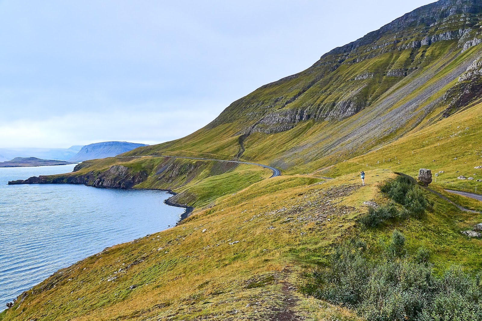
Between the Hvalfjörður area and the Þingvellir National Park we saw some amazing rugged beauty and stopped frequently to try to capture it!

For anyone who has had the opportunity to drive the Cabot Trail in Cape Breton some of these images may bring back memories. That is certainly what came to mind for me as we drove through these areas.
Note a tiny Michael in the distance
I am unable to say where all of these images were made except that they are somewhere along our drive to Þingellir National Park.

Below, Rod is aiming at a relatively small waterfall (which you won't see). He is down behind the rocky area for two reasons. The most important one is that the wind was incredibly strong that day, so strong that you could literally lean into it almost without falling, and it was virtually impossible to hold the camera steady enough to get a reasonable photo. The second, of course was that his location offered a better view of the falls. 
I don't recall for certain why we stopped in this location below though I think it was to take photos of several swans swimming in this small pond near the road.

I noticed and liked the colorful house (below) peeking up just across the road.


At the same spot just before leaving I stood in the middle of the road to get the photo below and just as I took the photo I heard a car approaching me from behind at a pretty good clip so had to move quickly to avoid disaster.


Inside the Þingvellir National Park near the huge fault shown in the photo on the right,  the AlÞingi - the world’s first “democratic parliament” was established by the Vikings in AD 930. It was in the adjacent rift valley, created by the separating junction of the North American and Eurasian tectonic plates, that they met annually for about 4 centuries (see above information). It is said that the plates are currently moving away from each other at a rate of 1 cm or more per year.
The image left, though not a very good photo, shows the fault ridge wall and 
the one to the right is the rift valley and somewhere out there is where the AlÞingi apparently met.

On to Geysir - site of the “hot springs” and, of course, geysers. It is said that this is the place that gave name to the general term "Geyser". 

The area is literally “teeming” with geothermal activity bubbling and steaming at or just below the surface, along with at least 3 geysers which release their burst of steaming hot water at various interval - the one pictured here had intervals of about 10 to 15 minutes.  
A bit beyond this one was an allegedly larger one that erupted every 30 to 60 minutes. We waited a bit but decided to move on to Gullfoss, the “Golden Falls” which is a relatively short drive from Geysir.
Gullfoss  - Iceland’s most famous waterfall - cascades down 32 meters. Once you see it you understand why is it is considered the most famous of the major Iceland waterfalls. It is a spectacular double or triple cascade of roaring water filling the air, and camera lenses with spray, - beautiful to see but not good for taking photographs unless you clean your lens frequently!  If you look at this image of the falls closely you will see, left middle, an outcropping where people congregate to get a better look at the falls. It's a bit tricky to get there as it is basically a walk over rocks wet from the continual spray. 


I managed to get up there with difficulty (fell gently to my knee once without serious consequences) and got many images of the falls. The ones I have include here I think captures Gullfoss, as well as I was able. 
There are lots of stories about the name - Golden Falls - but the only one that sticks in my mind tells of a man who once owned the property on which the falls is located. He was apparently very wealthy with lots of gold. It is said that he was so fearful that someone would rob him of his gold that he decided to hide it in the falls. Getting it in was easy, getting it out would have presented more of a challenge!


After Gulfoss,  home for a great Rod Marr meal, hopefully a hot tub and photo processing. Unfortunately, the barbecue lacked fuel and smelled overpoweringly of fish forcing a more difficult meal preparation for Rod. The meal was excellent in spite of the difficulties!

Thursday, September 14, 2017

Iceland

The long planned trip to Iceland, mentioned in the previous blog was, unfortunately, postponed because of an acute illness that presented itself the day before departure. After spending half a day in the Perth Emergency department for early treatment and a week of antibiotics, recommended diet and continual improvement, I was persuaded, thankfully, to go ahead with the trip. So, after a lot of reorganizing with airlines and accommodations in Iceland, we set out on Friday for a  very smooth approximately 5 hour flight on Icelandic Air.

Remember that you can click on any image to see a larger version.
One inside view of Brekka.
We arrived in Iceland at 11:30 pm (there is a 4 time zone difference). From the airport to Reykjavik, where we were able to pick up some groceries, is about a 40 minute drive. From Reykjavik the drive to our very pleasant nordic cottage, Brekka Lodge, which took us through a 6 Km tunnel under the bay, was another 45 to 50 minutes. So, though we arrived at 7:30 pm our time, by the time we reached Brekka and got settled it was well after midnight. We slept latish and relaxed a bit in our new surroundings. The view from the deck of water and mountains was quite spectacular and a great introduction to even more amazing topography that we were to see in time.

Below is a view from the deck of the lodge.


Later we drove to a relatively short distance to a waterfall (Glymur) - it was a long rocky climb from the parking lot and we discovered after more than an hour of walking that we still had another hour to go through quite difficult terrain so we aborted the walk.

At one point on our way back from the hike there was a nice view of the bay which we can also see from our diggs at Brekka.

Waiting for me.


Later Michael heard from his contact here that “you need a helicopter to get to that one”! After returning to the car we went to Reykjavik to shop for groceries and wine and beer.


We spent the evening editing photos and just chilling out. We intended to use the geothermal heated hot tub but initially it was too hot and later, when the hot tub was ready the weather had turned cold, windy and rainy and we were tired so some of us just relaxed, sipped some wine then went to bed.

Below is a view from the deck of Brekka just after sunset.

Because our time is so limited this may be both the first and last blog post from Iceland.

Monday, August 28, 2017

August 2017

It’s been about a year since my last blog post (so I’m a bit rusty) and our August 2017 at Crow Lake is in its final days!

(Remember, you can click on any photo to see a larger version.)

But 2017 activities began a bit earlier.

As in recent years Bob James and I came up in June to “open” the place with the main job being to get the water system filled and functioning. The Spring in Ontario has seen record breaking rain so the water levels in the lakes has been extremely high and when Bob and I were here we found the dock under water, a water level that we have seen only once before in our 40 years here.

The next activity was at the end of July when our friends Rick and Joanne spent a few days here - a time which turned out to be more eventful than they had planned. During their stay the pressure valve on our kitchen hot water heater failed, spreading hot water over the kitchen floor. Fortunately, Rick knew how to deal with the immediate problem but we still needed a new hot water heater before our next guests -  long time friends Vic and Babs along with their son Mark and his wife Robynne Edgar and their boys, Jacob and Coleman as well as V and B’s youngest son, Reid. Eight people without hot water in the kitchen would have been a challenge. Fortunately I was able to install the new heater in time for their 3 day stay.

Sorry, only a few photos from those visits. Not sure how that happened.

Not sure if that is Reid or Vic in the canoe.

Below, that is definitely Reid swimming but not quite sure if the other is Mark or Jacob.

On to August, which, as usual, has been a great month for us though a bit quieter than many. Thankfully, Michael was able to be here for a long weekend during the 5 days that Ann and Pat and Shayla and Ryan were also here.


Shayla has two rather large "ducks" - this is the larger of the two. Both have been given names - the smaller is Daryl and this one's name has varied so I'm not quite sure what it is.

And for part of a day we were joined by Jesse, Ruth's godson, and his partner Theresa.

Jess is an avid fisherman and Michael had brought his new fly fishing rod so they had a bit of a fly fishing "expedition".

Michael and Jesse perhaps in conversation about fly fishing.
Ryan has also developed an interest in fishing and he spent quite a bit of time catching fish both from the dock and the canoe.


Ruth and I have had to manage on our own, along with Kita and some local Loon friends, 
for the rest of the month while we look forward to a brief visit with Rod and Hope before Michael, Rod and I leave from Toronto for 14 days in Iceland!


So, stay tuned as I hope to post the next blog with images from Iceland, images as good or better than this Crow Lake sunset!

Tuesday, May 31, 2016

The End of This Trip

I know that I sort of implied in the last post that our trip had ended and, in a way it had, but in another way it was not yet complete.


As I mentioned at the end of the last post,
Kita enjoying the morning walk
we stopped at our second home by Crow Lake for a 4 day weekend with Michael. He arrived Friday evening around 11 pm (one day later than originally expected due to Thursday being occupied by important stuff at work). On arrival he told us that he had run into a deer on his way here from the airport! The animal suddenly appeared in front of the car and there was no chance to avoid hitting it or stopping. Fortunately he was not injured and the damage to the car appeared to be surprisingly minor.
Cribbage on the deck - but, why the oranges?
We lucked out with the weather as it was a beautiful 4 days with lots of sun and warmth with highs in the high 20’s, even 30 C on one day. Warm enough one day that Michael actually immersed himself in the lake to cool off and  he found the water to be surprisingly temperate. Swimming in Crow Lake on Memorial Day weekend has been a bit of a ritual for a lot of years but it was more often a “chilly challenge” than a means to cool off and usually it was Ann, occasionally Michael, and, more recently, Shayla and, possibly, Ryan who stepped up to the challenge..
To keep the cards from blowing away - of course.
At least on one of our morning walks it was sufficiently warm and humid that even the mosquitoes were there in fewer numbers.
In addition to the regular early morning walks there were others as well, a couple later in the day along our usual route on the road and one at Meisel Woods on the west side of Crow Lake. And Kita enjoyed the freedom of the walks and this morning she had her first encounter with a wild “critter”, closer to her size than the usual squirrels and chipmunks, in the form of a red fox! The chase was brief; there was a bit of a yelp when Kita caught hold of the fox, also briefly, and then a there was a stand-off for a few seconds before the fox took off again into the trees. Kita went after it but we presume the fox was quicker as Kita soon came back to join us on the walk. No injuries to Kita - not sure about the fox.
Meisel Woods
More Meisel Woods
On Saturday Michael and I did a bit of grocery shopping which included a visit to the nearby  “gourmet”  meat store, “Seed to Sausage”, where we picked up steaks, burgers, some of their specialty sausages and bacon as well as cheeses and condiments.  It was fortunate that we worked in our walks because, as you can discern, we ate well! And the great weather made it possible for our snack times and meals to be outdoors, either in the gazebo or on the deck.
Reading


There was a game of “13 handed rummy” and a little cribbage happened on the deck as well as the usual reading. With good internet access we were also able to watch a couple of Blue Jays games on the computer monitor.


A great weekend made even better by a classic Crow Lake sunset!

Michael left today so now the work of getting organized and shrinking the volume of our paraphernalia. Some of it we will leave here so that we can deliver the Thule roof top carrier to its source on our way back to Dundas on Thursday, June 2nd.
That will be the end of our trip which began on April 26th.


Saturday, May 28, 2016

St. Anne des Monts to Notre Dame des Neiges and further!

Another nice day and we were able to get a pretty early start on our trip to Notre Dame des Neiges. At this point on
our journey we are beginning to feel that we are gearing up to get home. Twenty- one days, or whatever it is, has been great but both the driving and unloading and loading the car every night and morning is increasing wearisome. So, once again we have planned no particular places to stop on our way to the Motel Trois Pistoles. (Apparently I spelled this incorrectly in the previous blog.) While on the topic of this unusual name it’s interesting to note that the word pistoles, according to the Oxford Dictionary, refers to “any of various gold coins used in Europe in the 17th and 18th centuries”. One source suggested that it referred to Spanish or Basque coins.
Snow covered mountains afar.
Lots of wind turbines.
Another also indicated that this area is one which was frequented by Basque whalers and fishermen in the same time period or even earlier. So, it appears that we are headed for an area with historical links to the Basques.
Now, for me the the number of photographs that I have made.is a measure of our feeling that this part of the trip is definitely homeward bound.  I think about 6 or 7 images! On earlier days I would likely make that many or more in one stop. And, from Motel Trois Pistoles to Drummondville, Québec, our next stop,  the number of photos was zero!.  As I mentioned in the previous blog post, I am not sure precisely where these photos were taken, with two exceptions. The photo above from Saint Flavie is interesting because someone has decided that it would be nice to have some sheep and a shepherd on the lawn by this building so, he/she created this "flock" of sheep, we think carved from wood, though we weren't able to get close enough to be certain.
On this part of the trip we noticed a couple of significant changes in the landscape. First, with the warmer and sunnier weather things are much greener in large part due to the deciduous trees having begun to sprout leaves. And the second change is in the topography. From St. Anne des Mont en route to Notre Dame des Neiges we are moving out of the mountainous region and, especially between Notre Dame des Neiges and Drummondville, flatter almost prairie like landscape. This is clearly farming territory.
In Notre Dame des Neiges we checked into a tiny motel, Motel Trois Pistoles, and a tiny room with a reasonably comfortable bed but no extras. We had booked this motel only a couple of days before and in some desperation as others we had tried who would take pets were full because of the beautiful long weekend. We were a bit surprised at a couple of things in this motel, most significantly the electrical arrangements.
There were very few outlets and the grounding piece on the air conditioner plug had been cut off to allow it to be plugged into an ungrounded extension cord! And the air conditioner itself had seen better days. We did not use it. The owners were very pleasant and friendly but the general state of repair suggested that they might be struggling to keep the motel in operation. Like a couple of other places we experienced, because  the owners lived on site they were able to keep a small business alive under difficult circumstances. But, it worked fine for us for one night then we were on our way to Drummondville and a few more comforts in a Comfort Inn. In walking the dog Ruth had discovered quite a lovely view of the valley south of the motel - see the photo above.
The drive to Drummondville was just that, a drive. We were now in high gear to get closer to home and we stopped once, maybe twice, during the approximately 370 Km drive. 
I have talked about going home but, in fact we were actually heading for our cabin at Crow Lake to meet Michael who will be there for the US Memorial Day weekend and the timing was working out perfectly as we had one day more than we needed in order to be there before Michael.  So, we decided to take another break and stay in Drummondville for 2 nights in ordered to rest and prepare for the nearly 400 Km drive to Crow Lake with a stop in Perth to pick up some groceries. And we are at Crow Lake as I write this and the photo left was made on our first morning walk.

It’s been a terrific trip and we are extremely happy we had the experience and we are equally happy to be here at our second home at Crow Lake!  We are now looking forward to a relaxing 4 day weekend with Michael before we do go home to Dundas.

Thursday, May 26, 2016

Gaspé to St. Anne des Monts

We had a good breakfast at the Adam’s Motel restaurant and got a fairly early start on
Somewhere between Gaspé and Farillon National Park 
another weather friendly morning.  The motel is close to the highway so we were able to leave the city quite quickly.
Just a word about my preconceived notions about the Gaspé Peninsula. I’m not aware of the basis for these preconceptions but I had pictured it as mostly flat with some hills and populated by a few folks living in tiny villages.
And there are, of course,  lots of small villages but there are also cities like Rimouski and Gaspé which are bustling places with lots of traffic and fast driving Québecers.
At Farillon National Park
And the topography I, obviously, had completely wrong. I had no idea, for example, that the northeastern tip of the Appalachian mountain chain extends from the south eastern USA to the Gaspé Peninsula and beyond, even to the Scottish Highlands, apparently.
Boardwalk at Forillon National Park
And, while these mountain are only a shadow of their former height due to erosion over a few hundred thousand years, some are still pretty high - Mount Jacques-Cartier in the Chic Choc’s,  for example, reaches 1,268 m.

First Lighthouse - note sure exactly where.
But onward.

Not long after leaving Gaspé we stopped at Forillon National Park at the far eastern end of the Gaspé Peninsula. Near the Park entrance and information centre there is a fairly extensive, very sturdy looking board walk. We decided to see how far this easy walk would take us and about 20 minutes later we were at the end. This is a large park with many kilometres of excellent walking/hiking trails but for many reason we are, unfortunately, not really able to make use of them, so we terminated our walk at the end of the boardwalk and returned to the parking lot.
As we hadn’t identified additional specific locations to visit, the remainder of our journey to St. Anne des Monts was punctuated by lots of stops at places where we hoped to find yet the perfect spectacular view and photo opportunity. The photo above on the left was made at what we thought might be place for lunch combined with a nice view. But the gazebo and the general area were not really very attractive so after this photo we moved on.
One of the towns mentioned below.
I think it worth saying that, while the trip was terrific and I certainly enjoyed it, it turned out, from a photography point of view, to be less rewarding than I had hoped. The weather was a major contributing factor with lots of rain and cloud in the early days.
Passing through...
Also, driving and hoping to find excellent views is tricky as so many of the “ones that got away” did so because they appear suddenly and fleetingly as we pass at 80 km/hr or so and there was no place to stop in any case.
On some roads there was little traffic so it was possible to stop and back up or turn around and reasonably safely pull off onto the shoulder long enough to make a quick photo or two but not really time to think it through carefully.  Another difficulty is presented by the time of day during which we are on the move - mostly during hours in which the light is not the best for good photos. Not excuses, just observations.
Second Lighthouse, not sure of the location.
During our Cabot Trail drive we were promised, by signs, that we would at some point come to a lighthouse, but we never did find one. On the Gaspé route, however, though there were no signs announcing lighthouse  we actually came across 3 of them.
As we had left Clifton Park on May 2 we have now been on the road about 20 days so, as you can imagine, note taking is less precise and the blur of time and places tend to make it difficult to match the photos with the exact location. 
We know that we visited Rivière au Renard and the towns of Saint Maurice-de-l’Echouerie, L’Anse-à-Valleau and Grande Vallée but which of the photos here were made near which of these places we can’t be completely certain. And, in the end, it probably doesn’t really matter.
We were there and enjoyed seeing everyone of them. The small villages nestled down in valleys at the water’s edge (obviously for practical reasons) all presented a lovely romantic image to passers by like us.
At this point we are still travelling through a pretty mountainous area so, as you can see in a couple of the photos, we often had a view from well above the villages.  One of the things you may also have noted in a couple of photos is that in each village, seemingly no matter how small, there is a fairly prominent church with steeple visible from afar.
The mountainous topography continues on to St. Anne des Monts, as indicated by the name, but before we reached St. Anne the road made its way out to the edge of the mountains and down very close to the shore, so the drive and the views along the ocean were much different from earlier images.
I have included a few images made from along the shore, one which shows a gathering of Gannets and we are both quite sure that the group of Gannets was near Riviere la Madeleine.
Around 4 pm we arrived in St. Anne des Monts and the Hotel&Cie, an unusual name but it was a nice motel and all arrangements were in order.

A cluster of Gannets
This was our most expensive place so far, partly because their fee for the dog was $35 per night! Again, by far the most expensive dog fee.


One night there so not time for two increasingly weary travellers to do much more than rest for tomorrow’s drive to Notre Dame de Neiges and the Motel Trois Pistales where we found ourselves in the most spartan of accommodations so far.